Google Earth time lapse feature lets you see the planet change over the last 40 years
If you have ever been curious about how much Las Vegas has grown since the 1980s or what Alaskan glaciers looked like in 1999 compared with today, Google Earth can take you on a virtual aerial trip down our planet’s memory lane. According to a Google blog post, Google Earth time lapse is the biggest update to Google Earth since 2017. You can use it to view areas of the earth at different points in time during the past 37 years.
What Is Google Earth Time Lapse?
Google used 24 million satellite photos from almost four decades to create an interactive 4D experience. The company collaborated with multiple agencies and organizations, including NASA, the United States Geological Survey’s Landsat program, the European Union’s Copernicus program with its Sentinel satellites and Carnegie Mellon University’s CREATE Lab.
The development required more than 2 million processing hours using thousands of machines in Google Cloud, all of which took place in Google’s carbon-neutral, 100% renewable energy-matched data centers as part of the company’s commitment to helping build a carbon-free future.
“As we looked at what was happening, five themes emerged: forest change, urban growth, warming temperatures, sources of energy, and our world’s fragile beauty,” Rebecca Moore, director, Google Earth, Earth Engine & Outreach, said in the blog post, “Google Earth takes you on a guided tour of each topic to better understand them.”
How To Use Google Earth Time Lapse
You can use Timelapse in Google Earth on a computer, an Android or an iPhone device. Open the Google Earth app on your phone or go to the Google Earth website. On the app, select Voyager on the left-hand menu, choose Layers and then select Timelapse in Google Earth. There you can discover stories, tour the featured locations or search for a location.
Another option is to visit the Google Earth Engine collection of Earth Timelapse videos. This curated selection of videos highlights different types of planetary change around the globe.

“You can select any video you want as a ready-to-use MP4 video or sit back and watch the videos on YouTube,” Moore explained in the blog post. “From governments and researchers to publishers, teachers and advocates, we’re excited to see how people will use Timelapse in Google Earth to shine a light on our planet.”
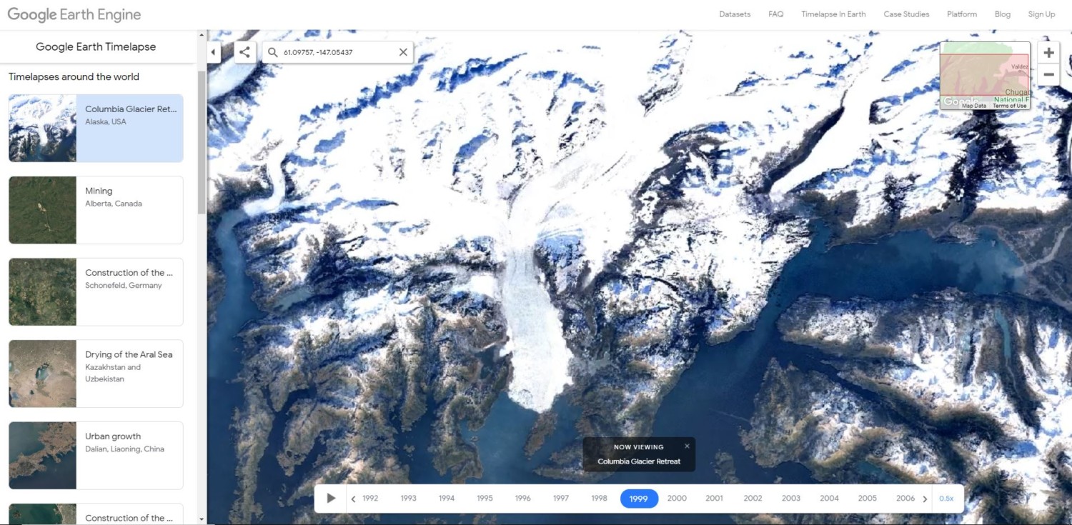
The highlighted time lapses include the Columbia Glacier retreat in Alaska, the drying of Aral Sea in Kazakhstan and Uzbekistan and bush fires in Yellabinna, South Australia. You can navigate to see deforestation, megacities, natural disasters, waterways, mining, infrastructure, and other featured stories and places.
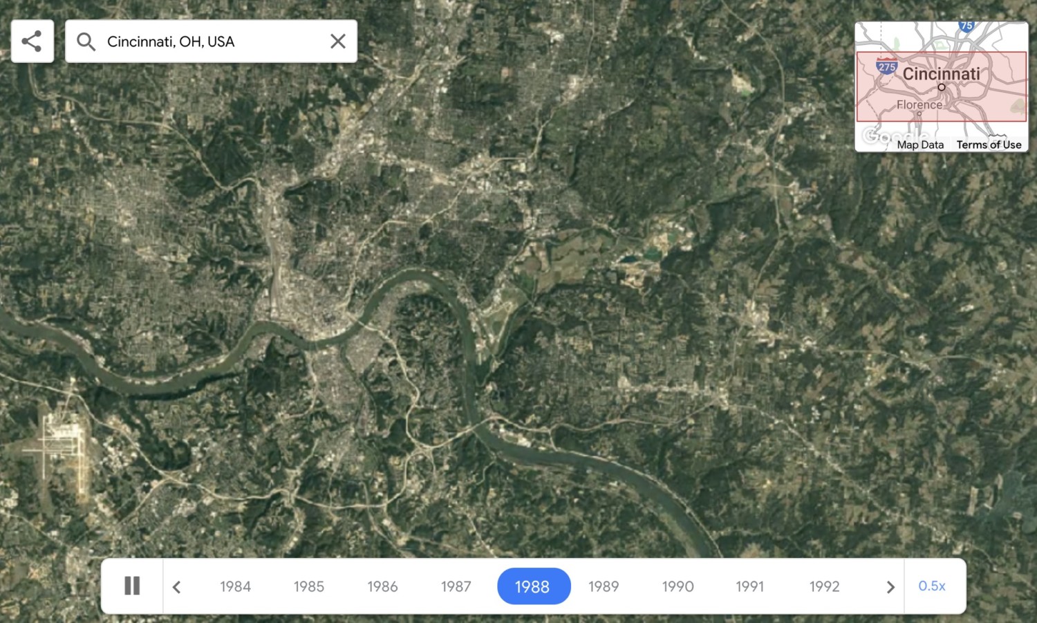
Alternatively, you can select the search button and enter GPS coordinates, a zip code, a country, a state, a city or even an address. You’ll zoom to the location in Google Earth, time lapse will begin immediately and you can watch an aerial progression of the location from 1984 to 2020.
Google plans to update the Google Earth time lapse feature every year with new imagery throughout the next decade.
Moore said in the blog post, “We hope that this perspective of the planet will ground debates, encourage discovery and shift perspectives about some of our most pressing global issues.”