NASA shares image of Hurricane Idalia from space
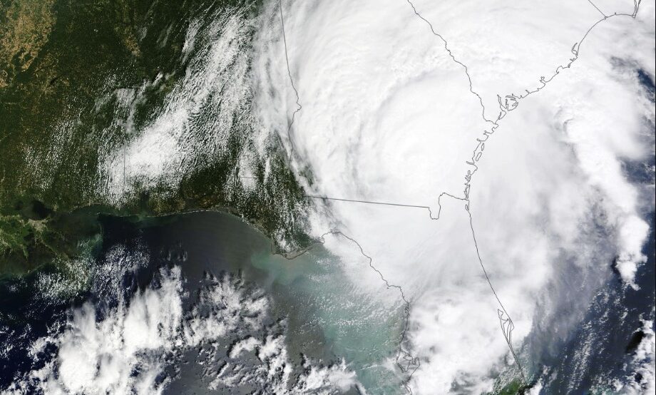
Hurricane Idalia has now been downgraded to a post-tropical cyclone and is now traveling across the western Atlantic Ocean to Bermuda. But it wreaked a fair amount of havoc as it made its way through the Southeastern U.S. and made landfall in Florida on Aug. 30 as a Category 3 storm. It was the most devastating storm the Big Bend area of the western coast had seen in more than a century.
When the hurricane reached land, winds were at 125 miles per hour, the National Hurricane Center said.
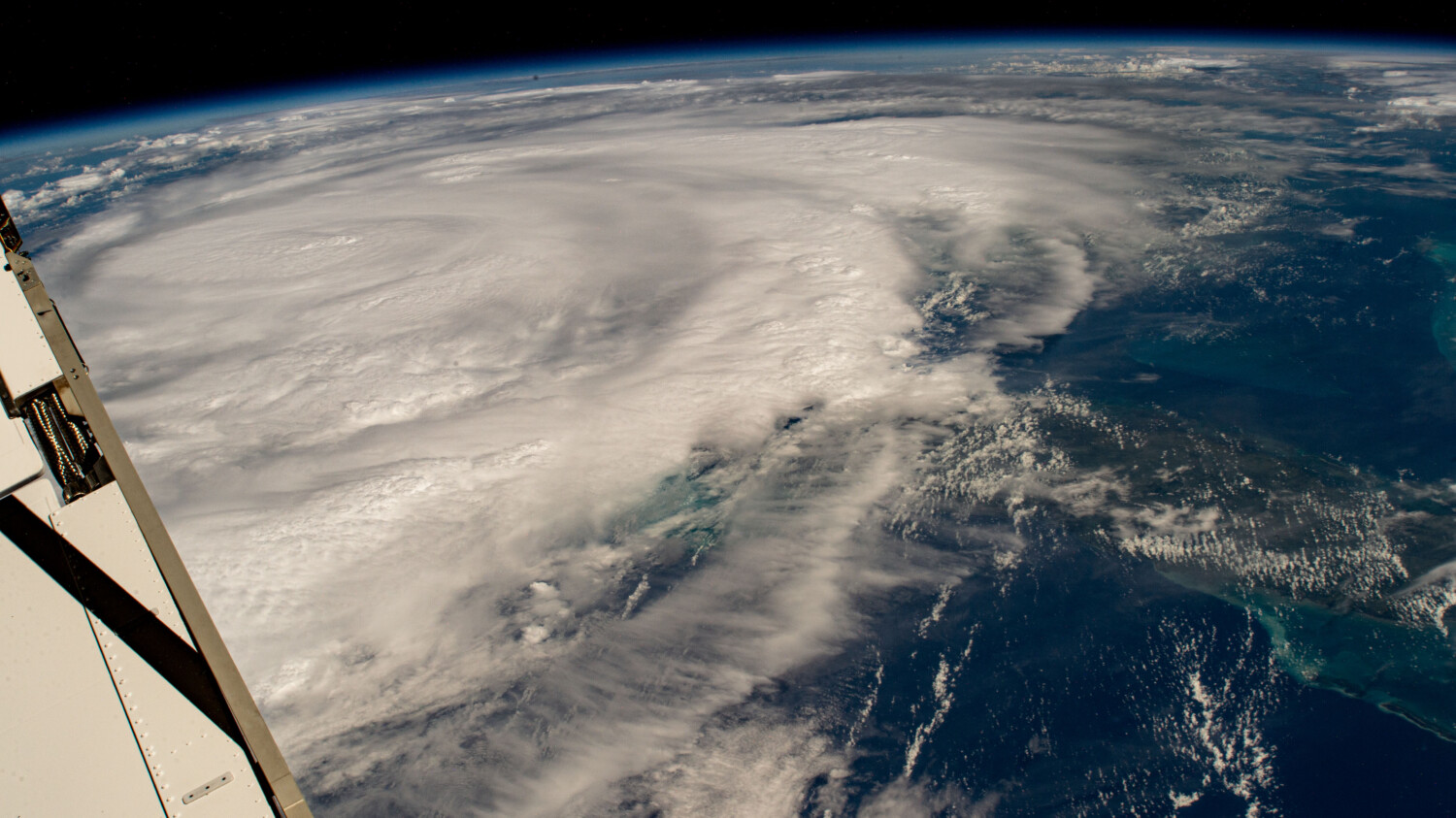
Ahead of the hurricane’s landfall, an external high-definition camera on the International Space Station captured an image of Hurricane Idalia in the Gulf on Aug. 29 that shows just how massive the storm was. NASA shared the image from the ISS — from its view 261 miles above Earth — on Aug. 30.
NASA’s Earth Observatory also posted an animation that shows the wind field of the hurricane during a 24-hour period between Aug. 29-30, using data from the Goddard Earth Observing System Model.
In this video from NASA’s Earth Observatory, you can see stronger winds in red and yellow, with the weaker ones in blue and white. NASA says that winds were at 74 miles per hour at the start of the animation and at 130 mph by the end.
NASA theorizes that the storm’s intensity increased because of high temperatures on the surface of the sea, low vertical winds and excess ocean heat content. The other storm, viewed moving away from the eastern coast of the U.S., is Hurricane Franklin, which was the first major storm of the 2023 season.
The National Ocean and Atmospheric Administration’s Climate Prediction Center believes we’re seeing an “above normal” hurricane season as a result of record-warm sea surface temperatures in the Atlantic. Its forecasters say we’ll likely see 14-21 named storms, which have 39-mph winds or greater. Between 6-11 of those could become hurricanes with 74-mph winds or greater, and at least two and as many as five could become major hurricanes, featuring winds of at least 111 mph.
According to NOAA, a storm with 74-mph winds or above will cause some damage to roofs, trees and power lines. Once hurricane-level sustained winds like those with Hurrican Idalia form, “devastating damage” can be expected. If the organization’s calculations are correct, people who live in areas of high hurricane risk (and even some who thought they were relatively safe, if Hurricane Hilary is any indication) may need a Plan B through Nov. 1, when hurricane season traditionally ends.
Related posts